in reply to Re^2: Calculate bearing between GPS coordinates
in thread Calculate bearing between GPS coordinates
For these cases, if I'm only hiking say 30-40 km, declination corrections not being preset shouldn't be much of an issue. If I find that it is during trial runs, I'll calculate that into the software and go from there :)
While i suspect that in most cases you will want to take the local deviation into account, in most cases you should also be able to get a general idea of it from your maps or just from memory.
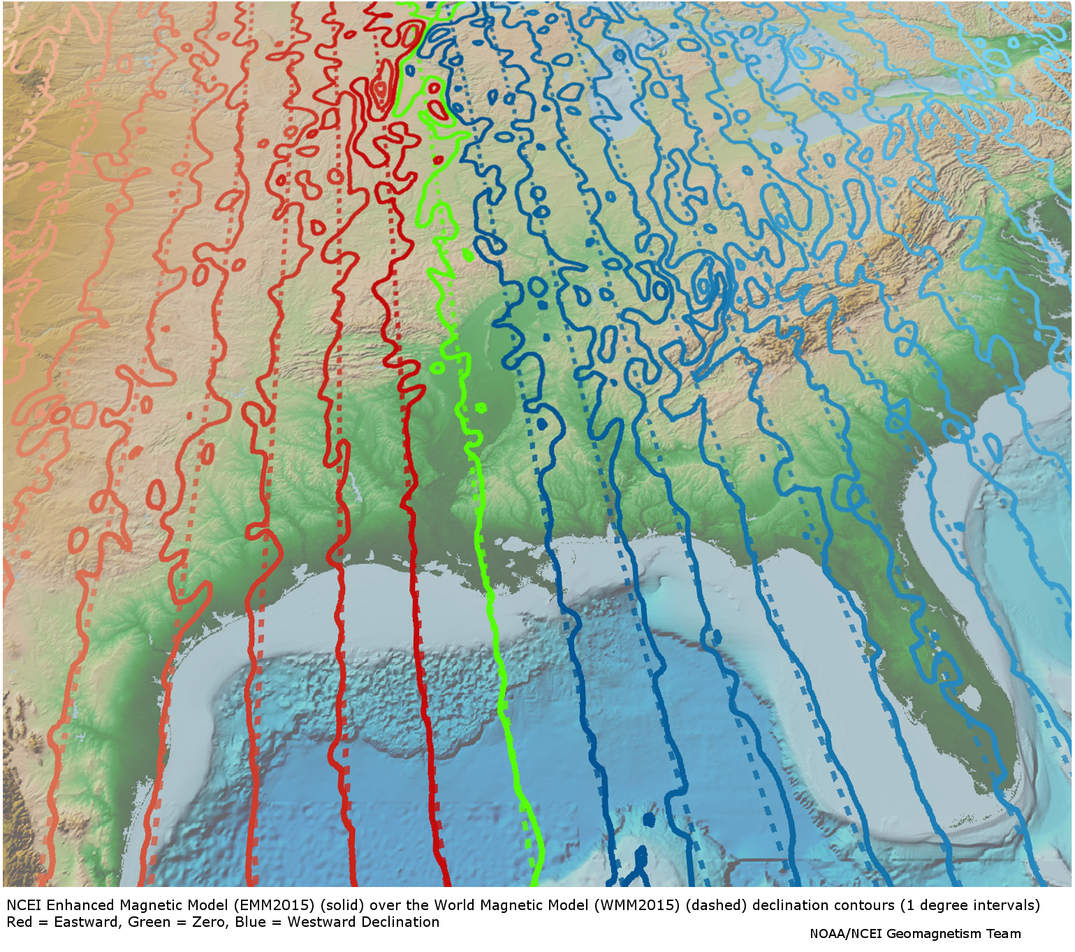
But in specific cases that may not be enough as local geological factors such as nearby magnetic materials can cause extra and sometimes large changes. (see https://www.ngdc.noaa.gov/geomag/EMM/img/dec_WMM_EMM.jpg via https://www.ngdc.noaa.gov/geomag/EMM/index.html. There are places in the USA where the deviation is 15 degrees.
Being somewhat of a fan of geological tidbits i kinda remembered running into a site that had a database. While it is not what i remember https://www.ngdc.noaa.gov/geomag/emag2.html seems to have a world grid database available that you may find of interest to subset and somehow contain on your deviceEdit:wrong data, that was not declination, but still an interesting dataset.
|
|---|